Risk Assessment - Australia Only
Calculates a risk assessment based on EPA Victoria’s (Australia) Guidance for assessing odour - Publication 1883, using the Plume Tracing Method.
Note: This tool only appears on the map toolbar when the site is using the EPA Victoria scales.
The risk assessment uses meteorological data supplied from the Australian Bureau of Meteorology, licensed under the Bureau of Meteorology Data Licence. Reproduced by permission of the Bureau of Meteorology, © Commonwealth of Australia.
Requirements
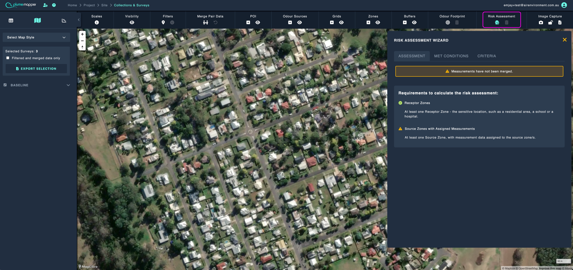
Before the assessment can be calculated, the site needs:
- At least one Receptor Zone - the sensitive location, such as a residential area, a school or a hospital.
- At least one Source Zone, with measurement data assigned to it.
If either is missing, the wizard shows a checklist telling you which one it is.
See zones, for more information.
Opening the Wizard
Click the icon under Risk Assessment on the map toolbar, to access the Risk Assessment Wizard.
The wizard has three tabs:
- Assessment - build and calculate the assessment.
- Met Conditions - the meteorological data behind the calculation.
- Criteria - the EPA Victoria criteria tables.
Assessment
Saved Configurations
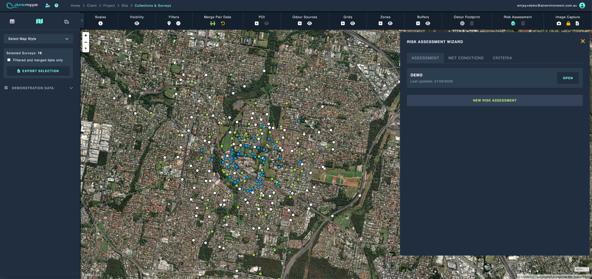
If the site already has saved configurations, they are listed when you open the wizard, along with the date each one was last updated.
- Click the Open button on a configuration to load it.
- Click the New Risk Assessment button to start from scratch.
Building the Assessment
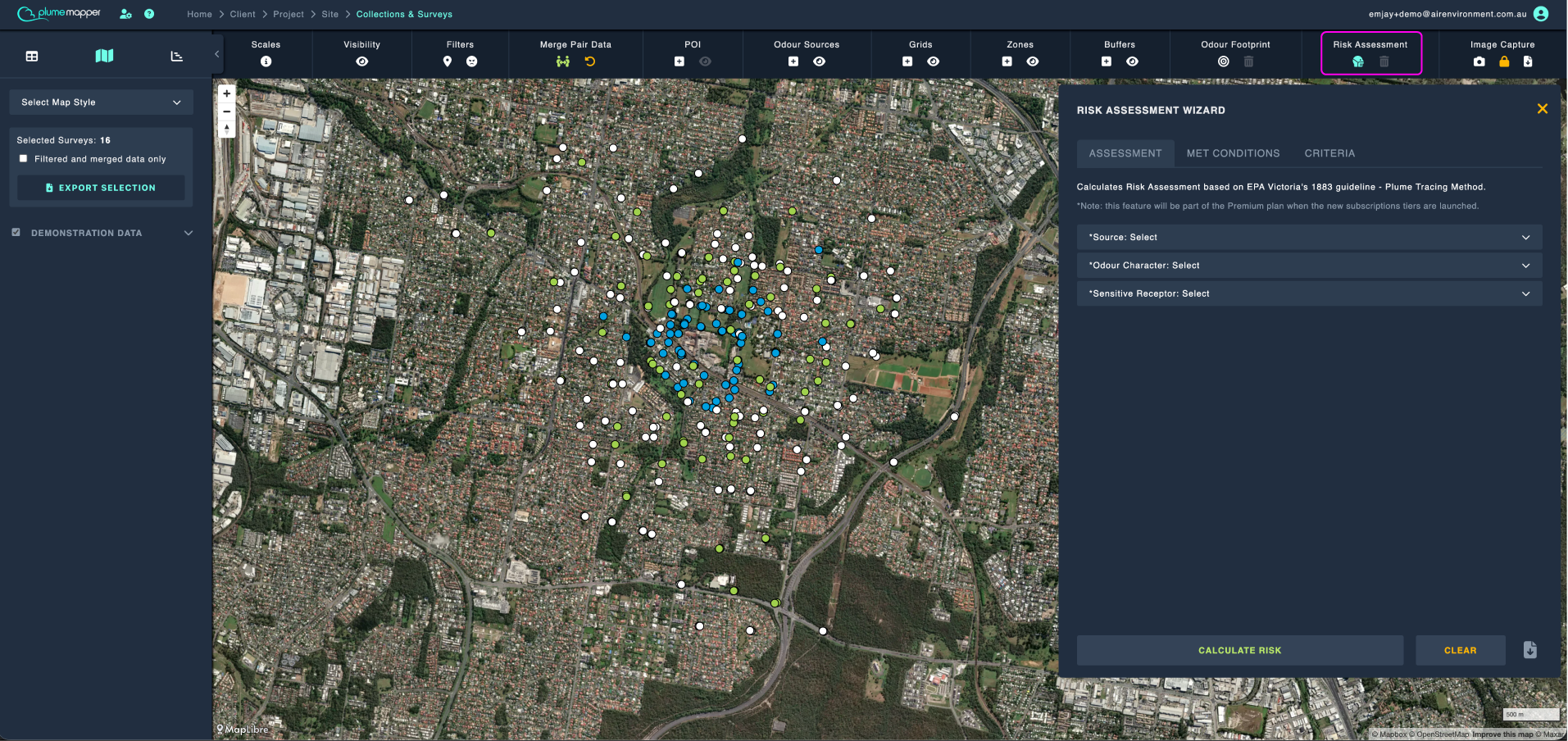
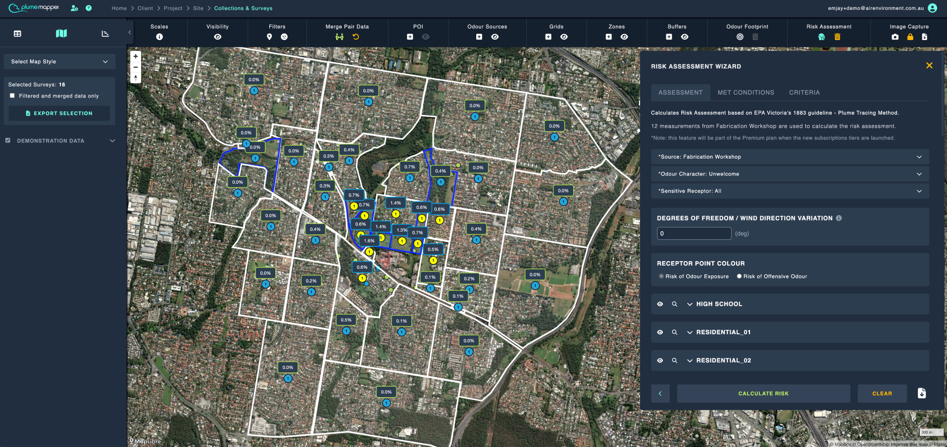
1. Select the Source from the dropdown menu.
- You can select more than one source; they are then merged into a single source and you will be asked to name it.
- Merging combines the selected sources into one. All their odour detections are re-measured to the nearest edge of the combined boundary, and the furthest detection per survey and intensity is used.
Note: Only merge sources that share the same odour character and sit close enough to act as one emitting area, to ensure accurate measurement of their combined impact.
2. Select the Odour Character - Unsafe, Unwelcome or Innocuous.
3. Select the Sensitive Receptor/s.
- Use All to select every receptor zone.
4. Click the Calculate Risk button.
A caption above the form tells you how many measurements are being used in the calculation.
Note: If your data contains paired measurements that have not been merged, a warning is shown. Merge them first for an accurate result.
Adjusting the Results
- Degrees of Freedom / Wind Direction Variation - how much variation from the wind direction is allowed, e.g. if the wind direction is 90° and the degrees of freedom is 10°, any direction between 80° and 100° is considered acceptable.
- POI Qualifying Distance Threshold - POI only count towards a receptor point’s sensitivity if they are within this distance (in metres) of it.
- Receptor Point Colour - colour the points by odour exposure or by odour offensiveness.
Note: Only POI inside the specified receptor zone are considered, even if they are within the distance threshold.
Results
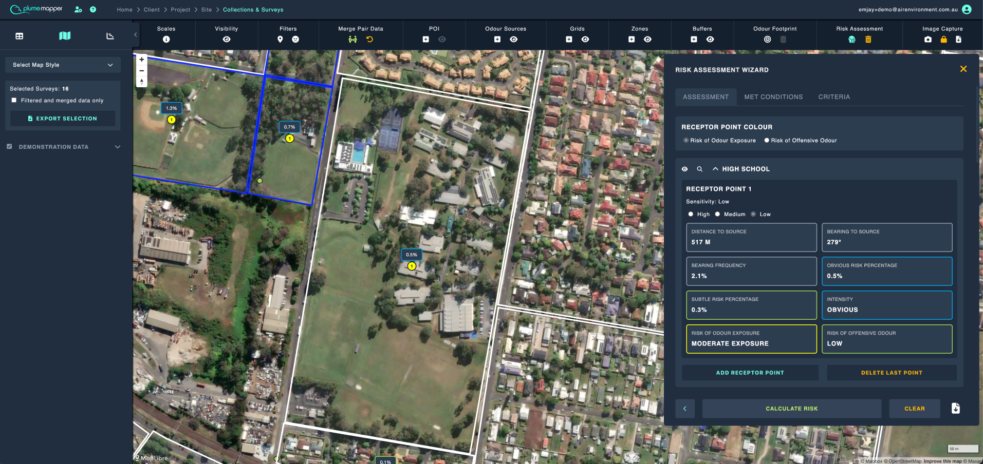
Each receptor is displayed in its own panel. Expand a receptor panel to view and manage its receptor points.
For each receptor point, you can view:
- Its assigned sensitivity rating.
- The number of qualifying points of interest (POIs) within the defined threshold. Select Show Qualifying POIs to view the full list.
Use the following controls to interact with receptor points on the map:
- / Show or hide the receptor’s points on the map.
- Highlight the receptor on the map.
By default, one receptor point is placed at the centre of each receptor zone.
- Its sensitivity is set to Low unless qualifying POIs have been added and one or more POIs meet the criteria for a Medium or High sensitivity rating. Refer to the Criteria Lookup tab to review sensitivity scores.
- If no POIs have been added, but you know the location should have a Medium or High sensitivity rating, you can manually update the sensitivity.
Drag a receptor point within its receptor zone to update the assessment based on wind direction and nearby POIs.
To add additional receptor points within a receptor, select Add Receptor Point.
To remove the most recently added receptor point, select Delete Last Point.
Saving a Configuration
Enter a name in the Configuration Name field, then click the Save Configuration button.
- For a configuration you have loaded, the button reads Update Configuration.
Note: If you try to leave a configuration with unsaved changes, you will be asked whether to update it or continue without saving.
Clearing the Assessment
- Click the Clear button in the wizard, or
- Click the icon under Risk Assessment on the map toolbar, to clear the assessment from the map without opening the wizard.
Exporting
Click the icon in the wizard footer, to export the assessment.
Met Conditions
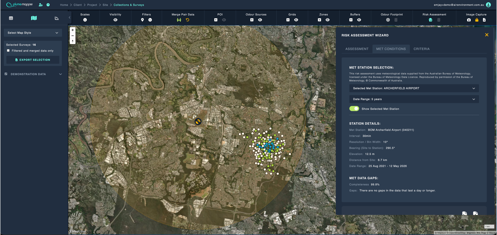
The assessment uses meteorological data supplied by the Australian Bureau of Meteorology, licensed under the Bureau of Meteorology Data Licence.
The panel shows:
- Met Station - the station used, with a dropdown to choose a different one.
- Interval - the angular resolution the observations are recorded at.
- Elevation
- Date Range - with a dropdown to choose how many years of climatology to use.
- Spread - how far the assessed measurements sit from the station. You are warned if they are not all within 10 km.
- Completeness - any gaps in the station’s record.
Toggle Show Selected Met Station to display the station on the map.
A wind rose for the selected period is shown beneath the panel.
Criteria
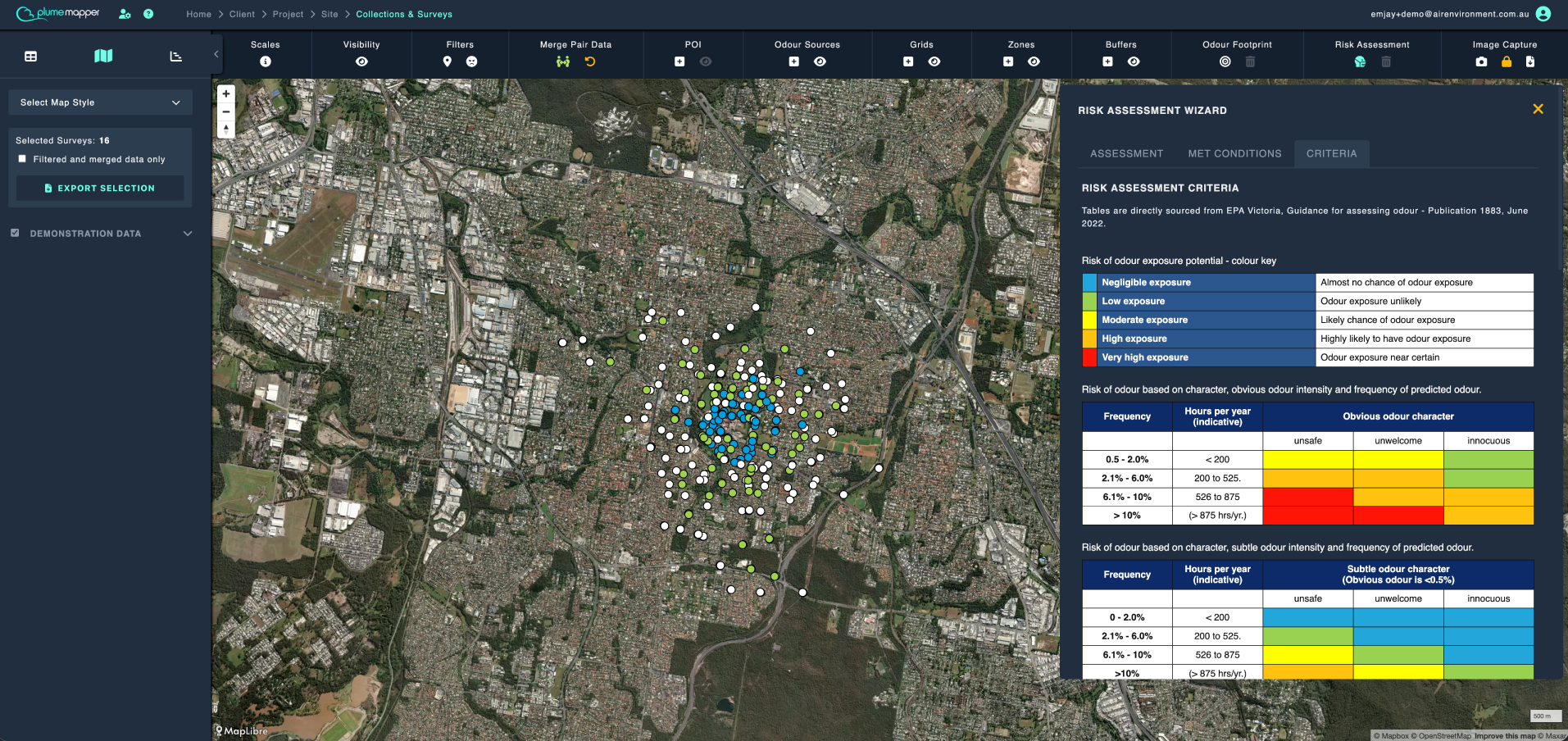
The tables are directly sourced from EPA Victoria, Guidance for assessing odour - Publication 1883, June 2022.
- Risk of odour exposure potential - colour key
- Risk of odour based on character, obvious odour intensity and frequency of predicted odour
- Risk of offensive odour key
- Risk of offensive odour
- Scores receiving environment sensitivity