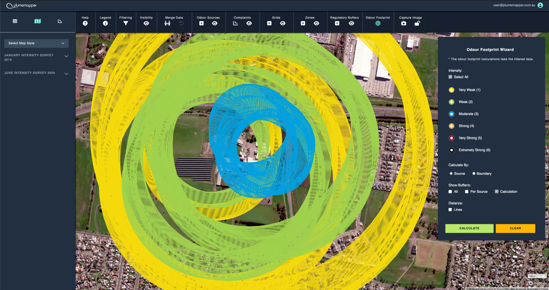
Odour Footprint
The odour footprint is calculated by first identifying the furthest measurement for each odour source at each intensity level recorded within the measurement data.
A 360° radial footprint is then rendered around each source zone, to map the furthest detectable reach of odour, creating a comprehensive spatial representation of odour dispersion.
Note:
For the odour footprint to calculate, you need to have source zones set up as well as measurement data assigned to that odour source.
See zones, for more information.

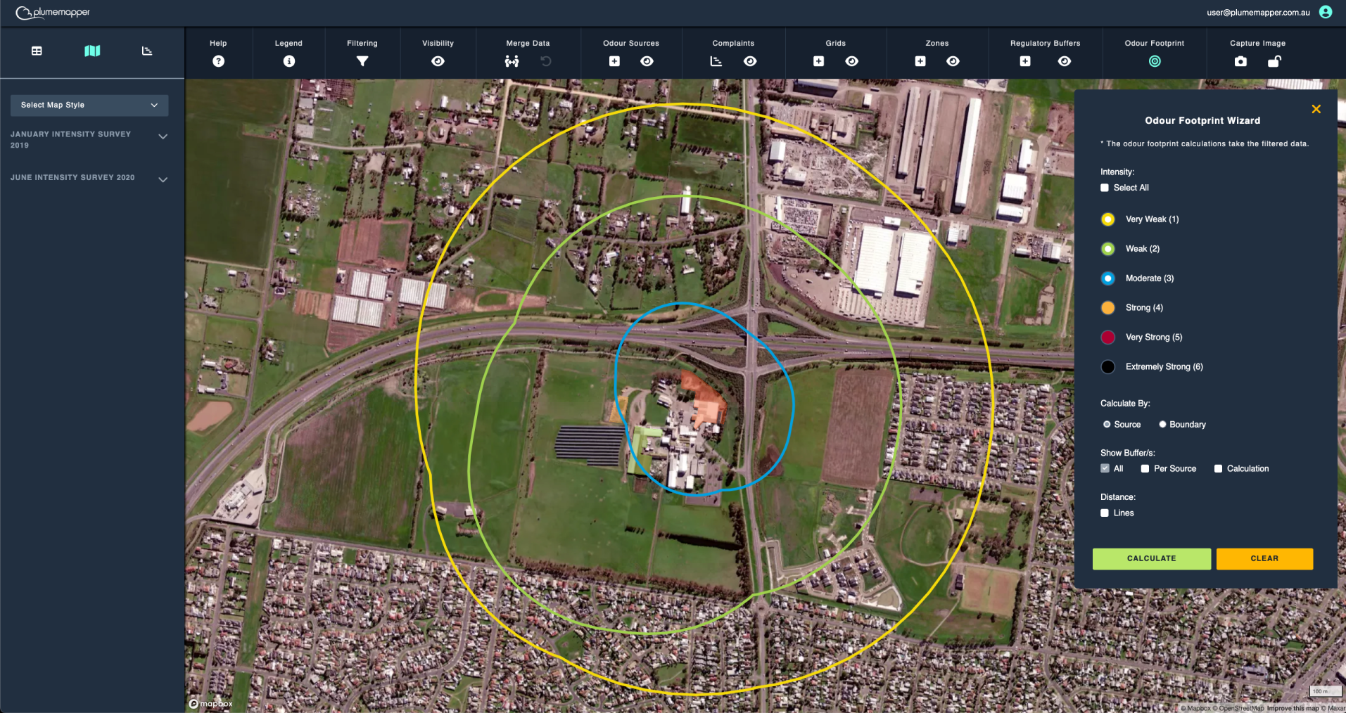
Odour Footprint: by Source
1. Select the intensity levels you want to show.
- Calculate by source will be selected as the default calculation method.
2. Click the Calculate button.
This will display the odour footprint calculated from all of the source zones, for each of the odour sources.
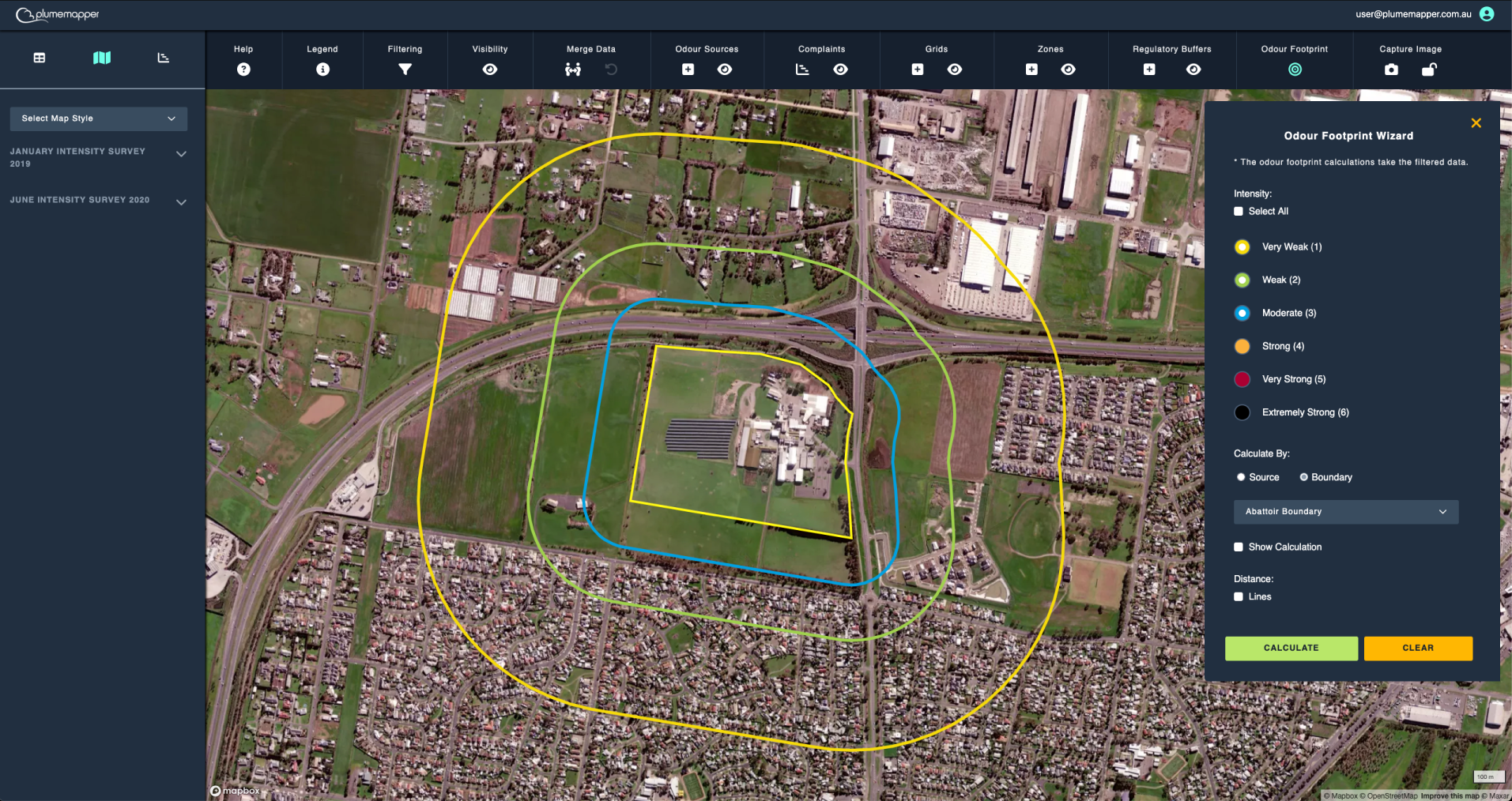
Odour Footprint: by Boundary
1. Select the intensity levels you want to show.
2. Click the Boundary selection.
3. Click the Calculate button.
This will display the odour footprint calculated from the selected boundary, for each of the odour sources.
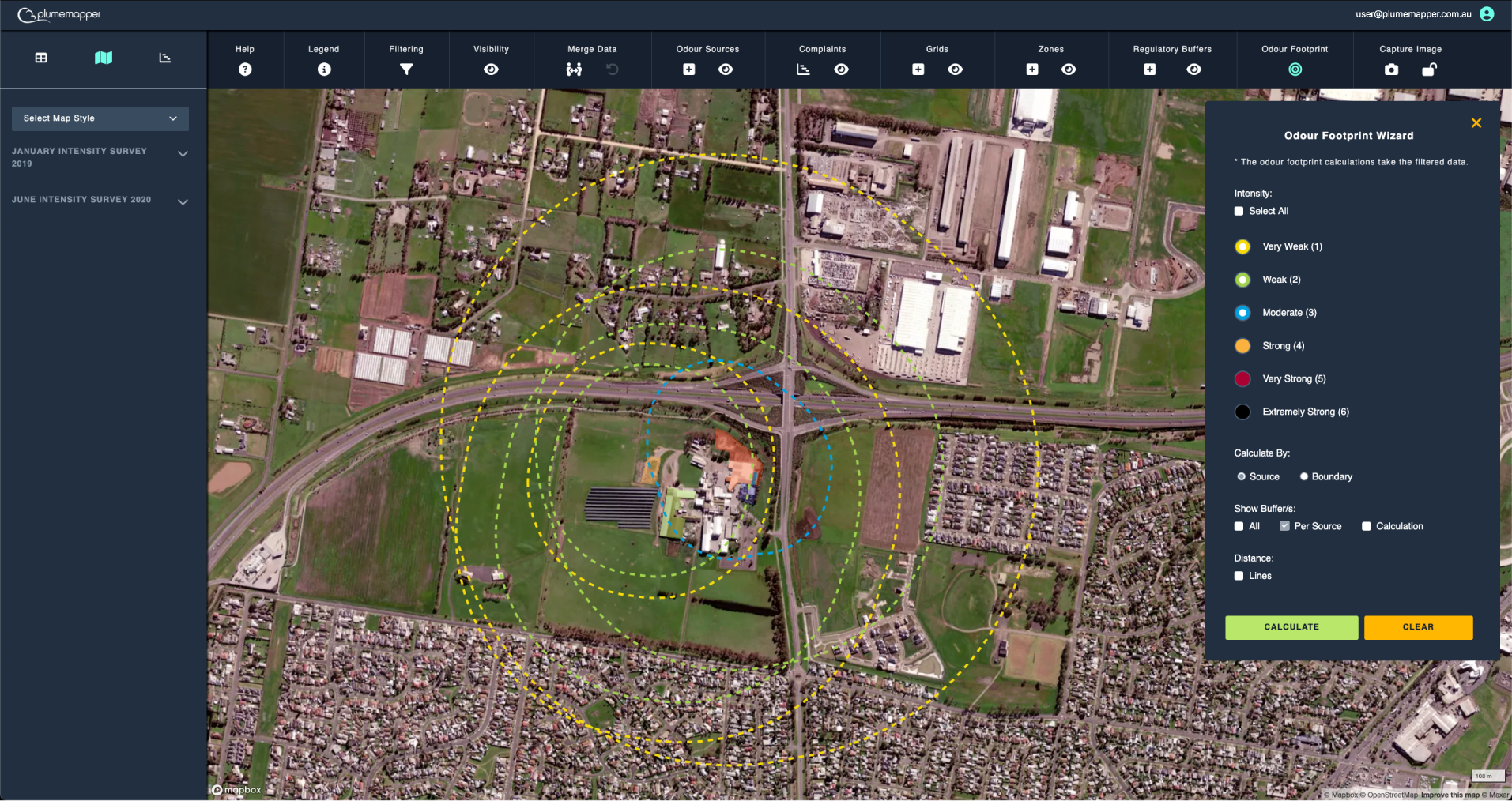
If you want to see the footprint for each of the source zones, click the Per Source selection.
Note:
If you want to only see the odour footprint for a specific source, independently - filter the data by that source.
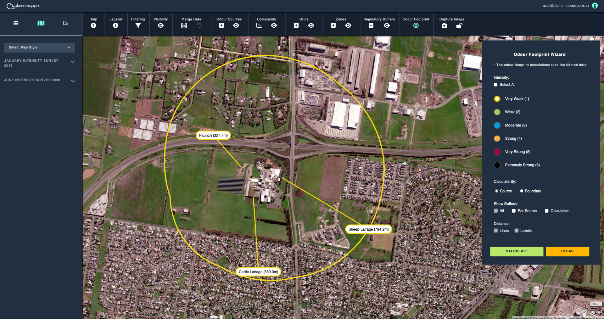
Show Furthest Point:
To see the furthest point from the source zones, click the Lines selection.
This will display the line from the source zone to the furthest measurement.
Then click the labels selection, to show which of the sources that measurement was attributed to.
Show Calculations:
If you want to see how the odour footprint was calculated, click the Calculation selection.
Click the Clear button to remove the odour footprint from the map.