Interacting with Map Features
Almost everything displayed on the map can be interacted with.
Measurements
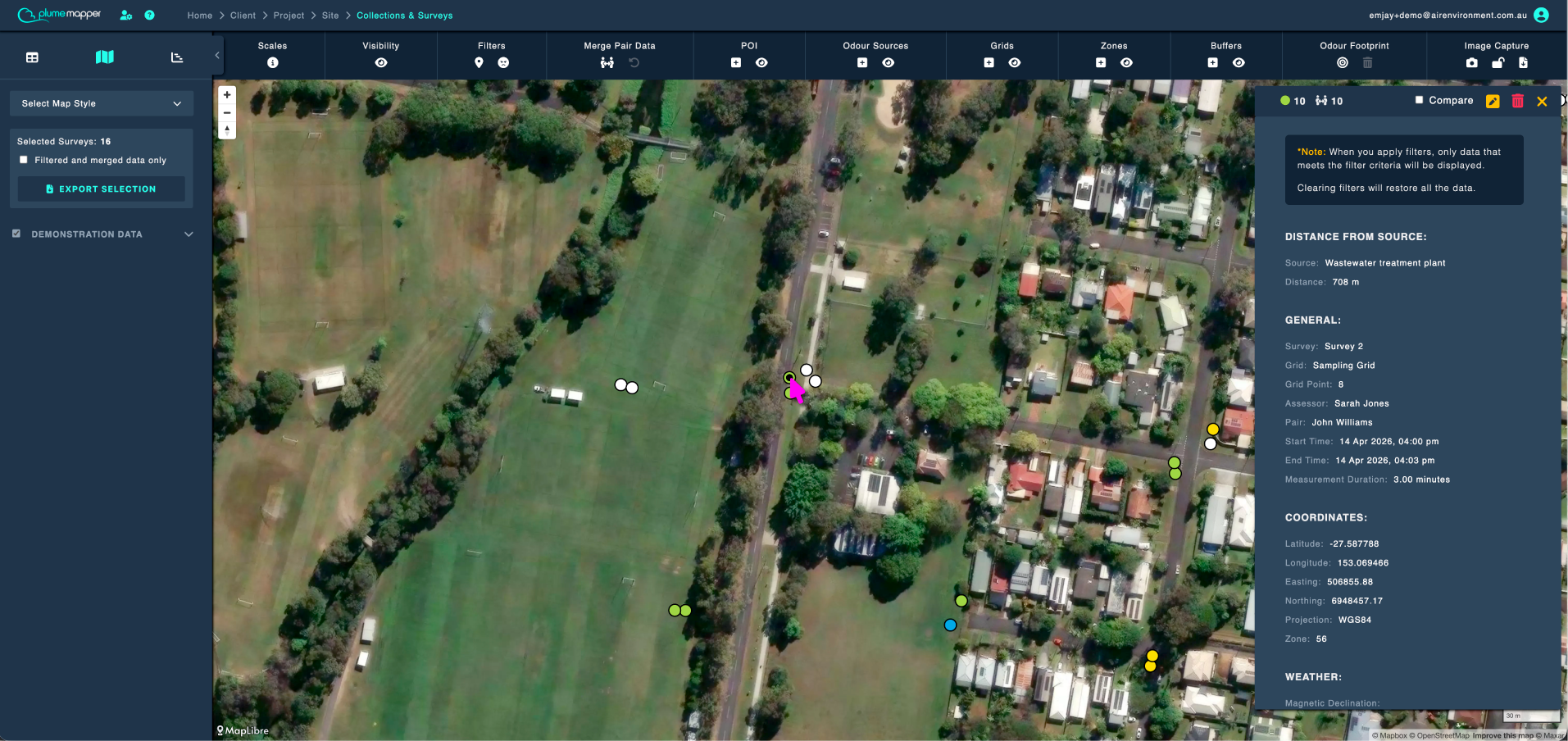
Click a measurement marker to open its details panel.
The panel shows the full measurement record, as well as the distance from each source zone.
edit the measurement.
delete the measurement.
close the panel.
Note: When you apply filters, only data that meets the filter criteria is displayed. Clearing filters restores all the data.
Comparing Two Measurements
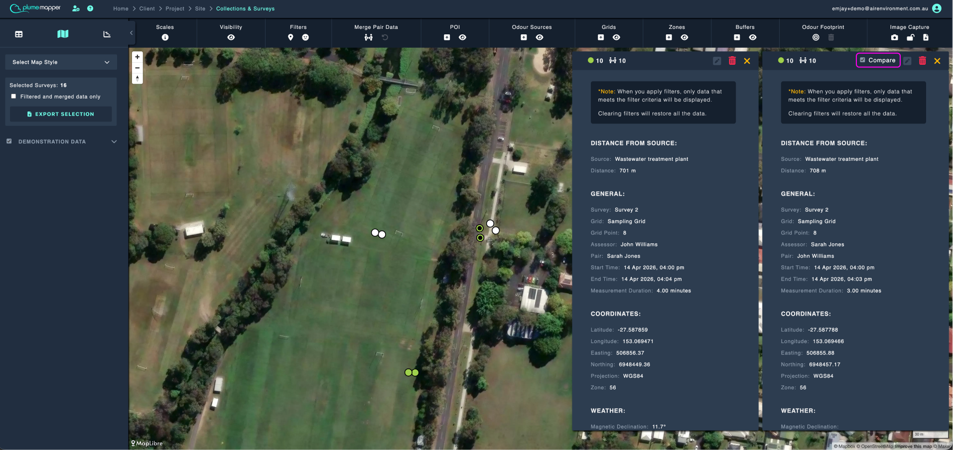
1. Check the Compare checkbox at the top of the panel.
2. Click a second measurement on the map.
- The two panels are displayed side by side.
Note: Editing is disabled while compare mode is on.
Note: If you edit a merged measurement, you will be asked which of the pair’s original measurements you want to open.
Viewing Data on Hover
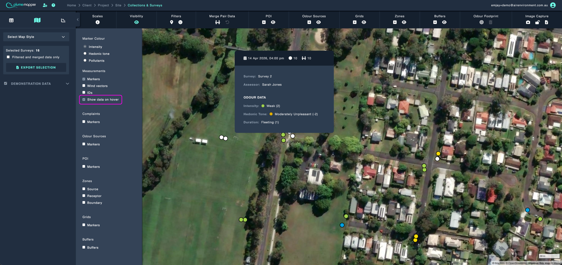
Check Show data on hover in the visibility panel, to see a snapshot of a measurement’s data without clicking it.
The snapshot shows the timestamp, measurement number, pair number, survey, assessor, odour data and pollutant data.
Zones, Buffers, Grids, Odour Sources and POI
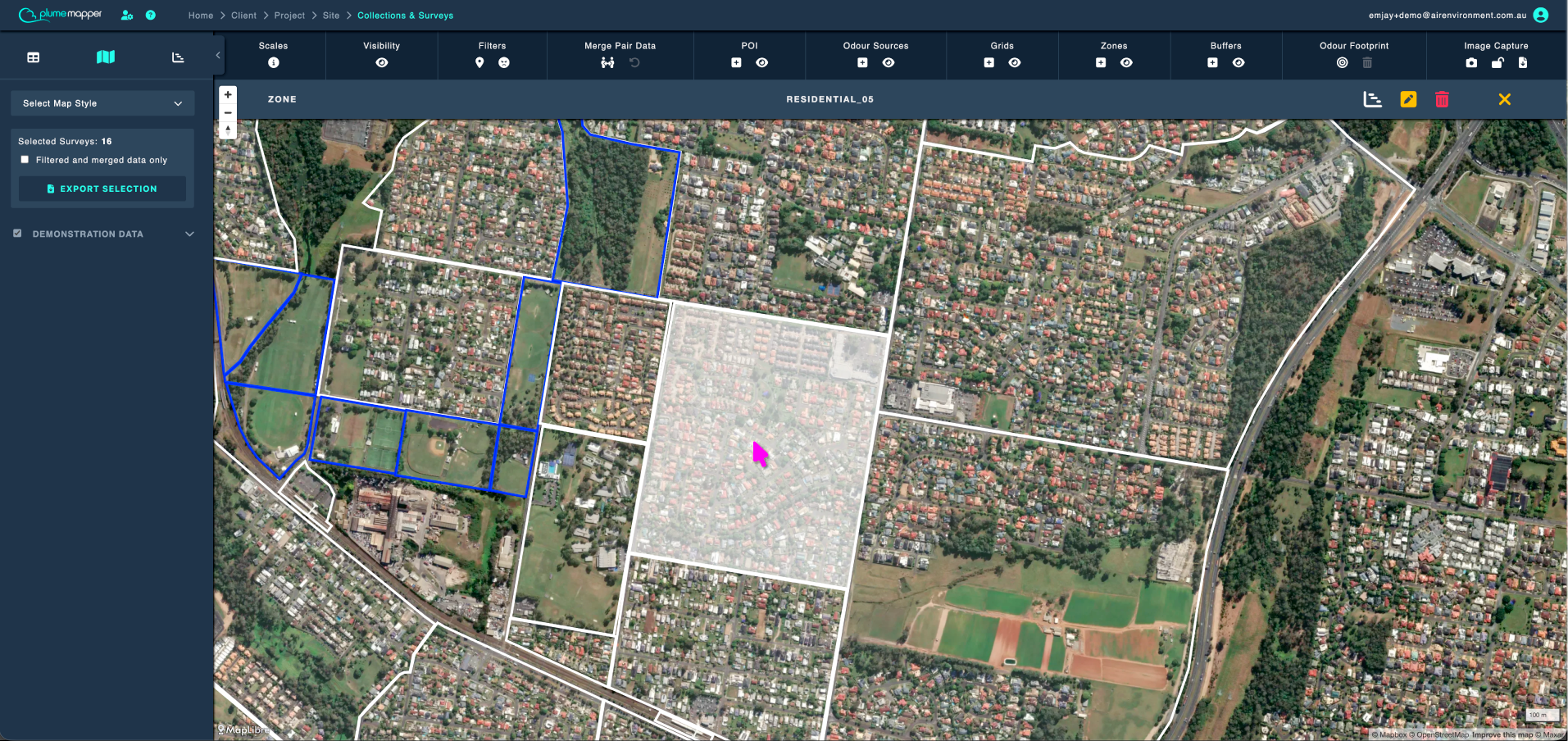
Clicking any of these selects it and brings up the edit bar at the top of the map, showing the feature type and its name.
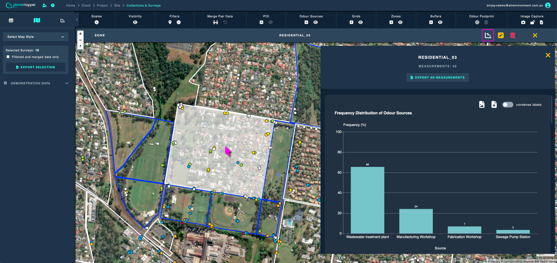
statistics - receptor zones and grid points only.
edit the feature.
delete the feature.
deselect the feature.
For a POI, the edit bar also shows its type and any notes recorded against it.
Which Part to Click
- Point buffers - click the centre point or any of the buffer rings.
- Polygon buffers - click anywhere in the polygon or any of the buffer rings.
- Zones - click anywhere in the zone.
- Grids - click any grid point of the grid.
Note: If features overlap, clicking cycles the layer order so you can reach the one underneath.
Statistics
- Receptor zones - frequency distributions by source, character, intensity, tone and duration, a wind rose, and distance by source and intensity, for every measurement inside the zone. You can also export those measurements from the panel.
- Grid points - the same statistics, for the measurements assigned to that grid point.
Deleting
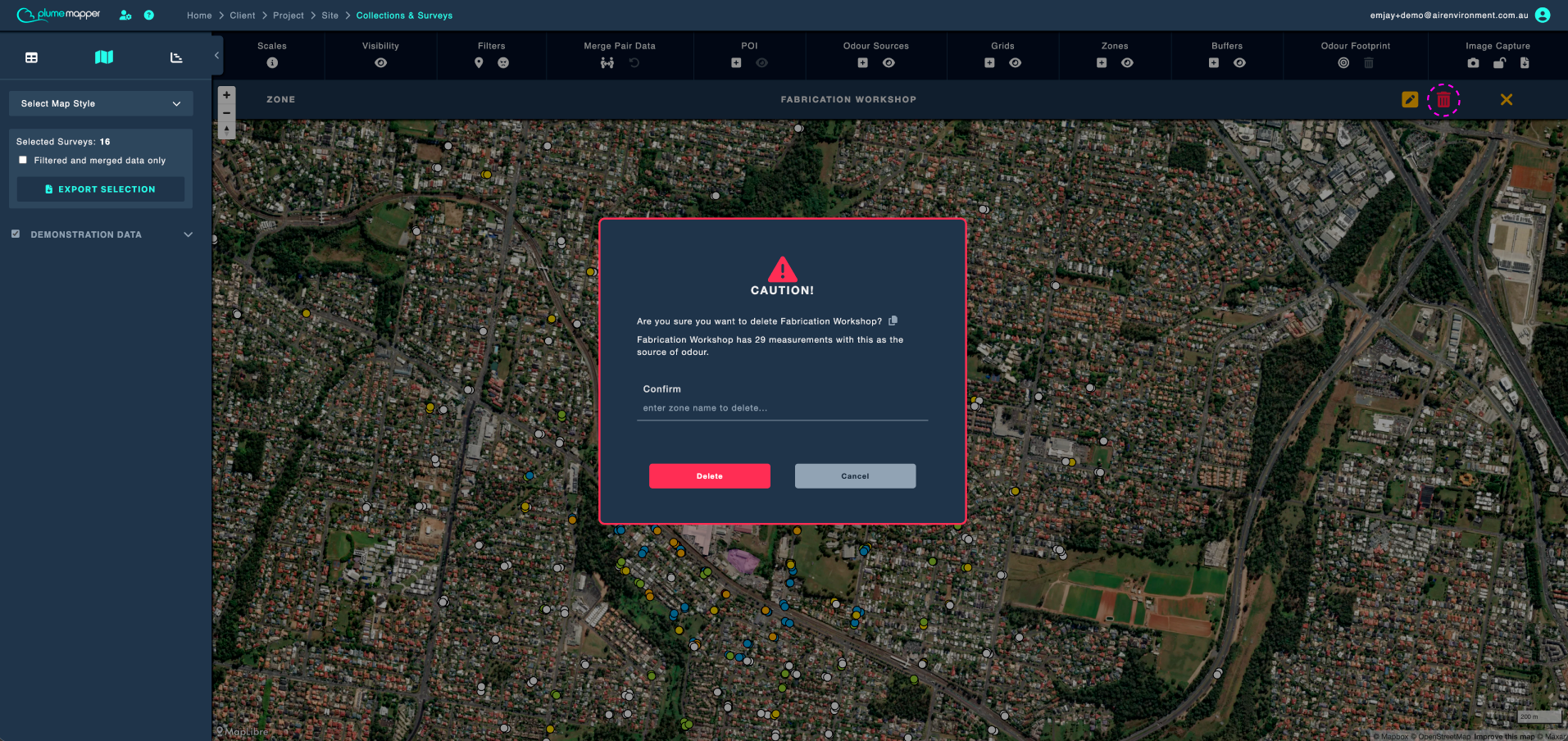
Some deletions ask you to type the feature’s name to confirm, e.g. deleting an odour source that still has measurements attributed to it.
Important: Deleting a map feature is permanent and cannot be undone.
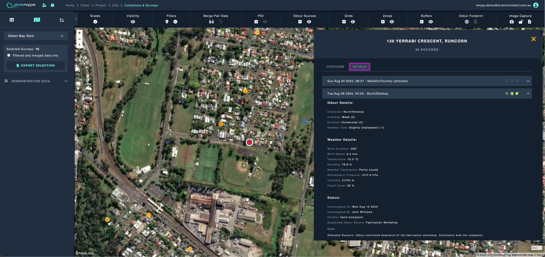
Complaints
See complaints for more information.
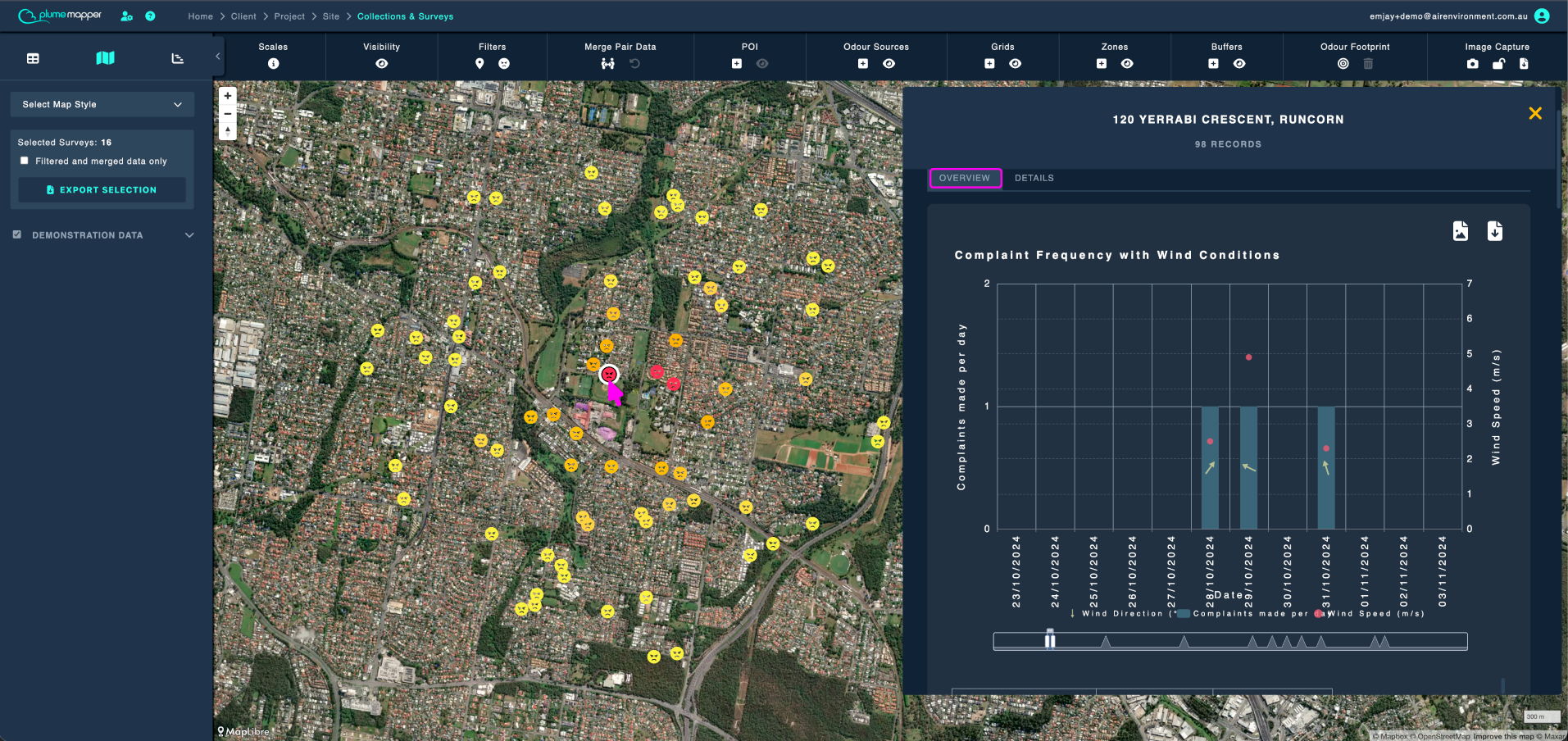
Complaint Overview
- Complaint frequency with wind conditions
- Frequency distributions by intensity, tone, duration and odour characters
Complaint Details
- Complainant details
- Odour details
- Weather details
- Status