
Viewing and Editing Measurement Data
You can view and edit measurement data from the survey map screen.
Instantaneous and timed markers are coloured by the highest recorded intensity within the measurement data.
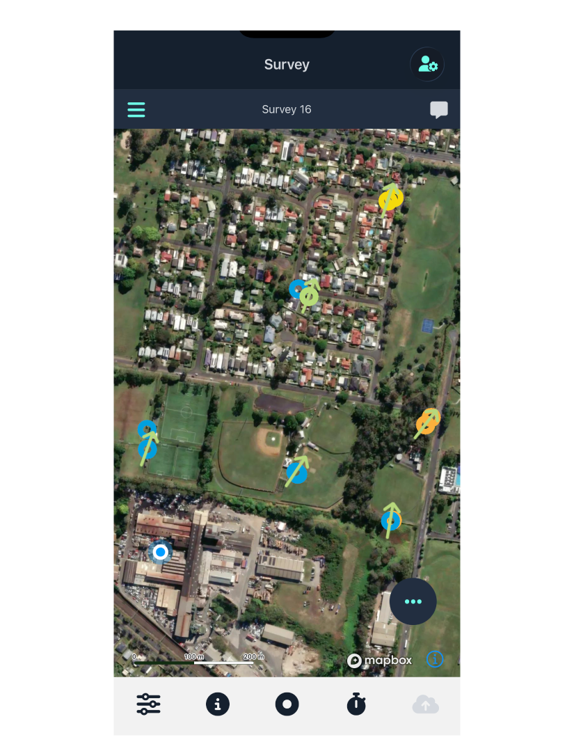
Tapping a marker opens the measurement details screen.
Measurement Details
The panel at the top of the screen shows the measurement and pair IDs. When comparing paired data, pairs can reference this pair ID and edit accordingly if necessary.
The measurement or icon is coloured by intensity level.
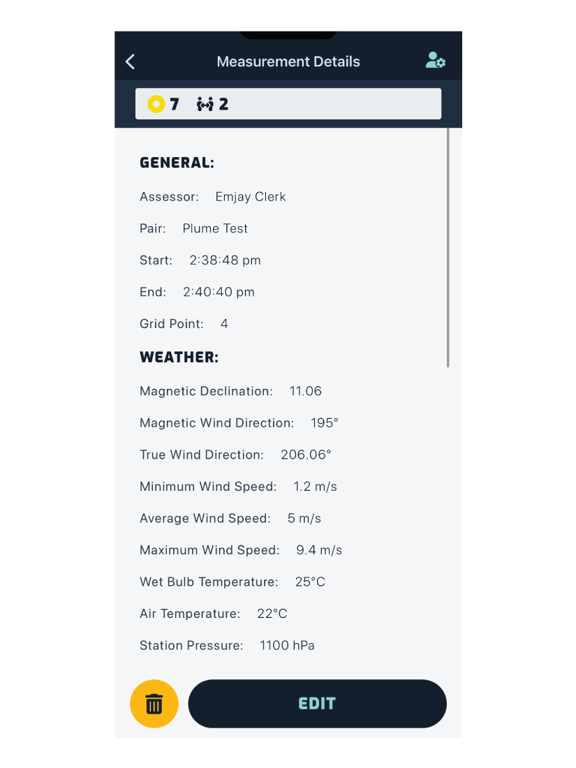
Instantaneous Data
The scrollable screen shows all the data collected for this measurement:
- General data
- Weather data
- Odour data
- Pollutant data
- Notes
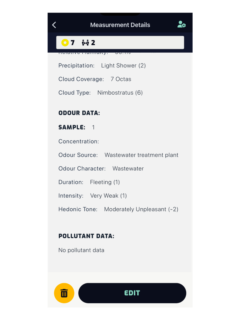
Tapping the Edit button opens the edit screen. See Editing Measurements below.
Tapping the button permanently deletes the measurement. This data cannot be recovered.
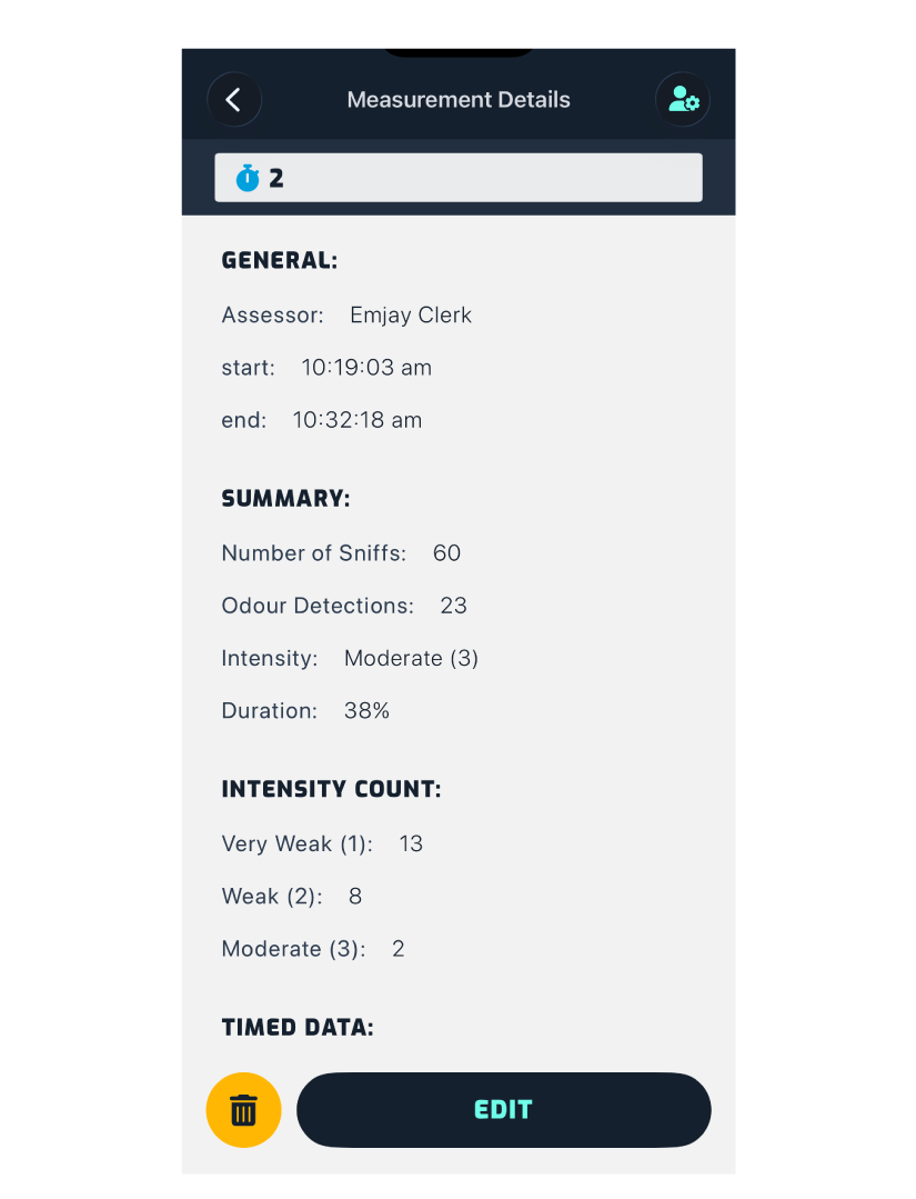
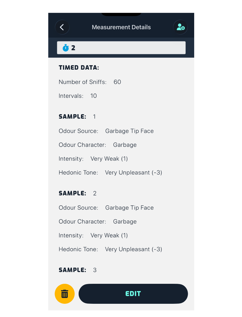
Timed Data
- General data
- Summary
- Intensity count / detections
- Timed data
- Weather data
- Weather updates
- Pollutant data
- Notes
Editing Measurements
Instantaneous
If the pairing information was accidentally left empty, you can enter the data and match the pair ID.
The same can be done for the associated grid point.
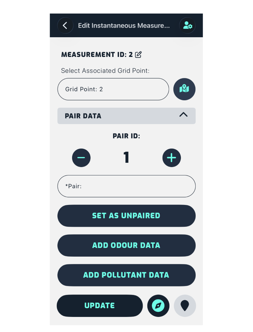
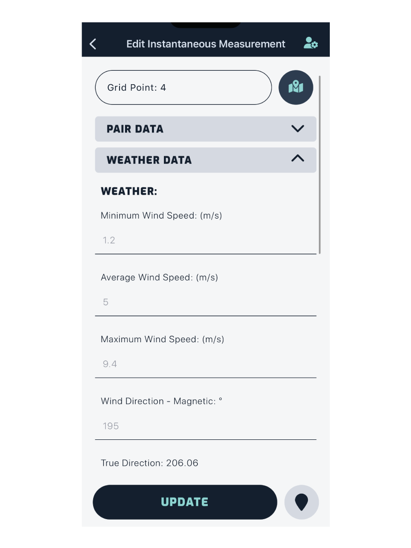
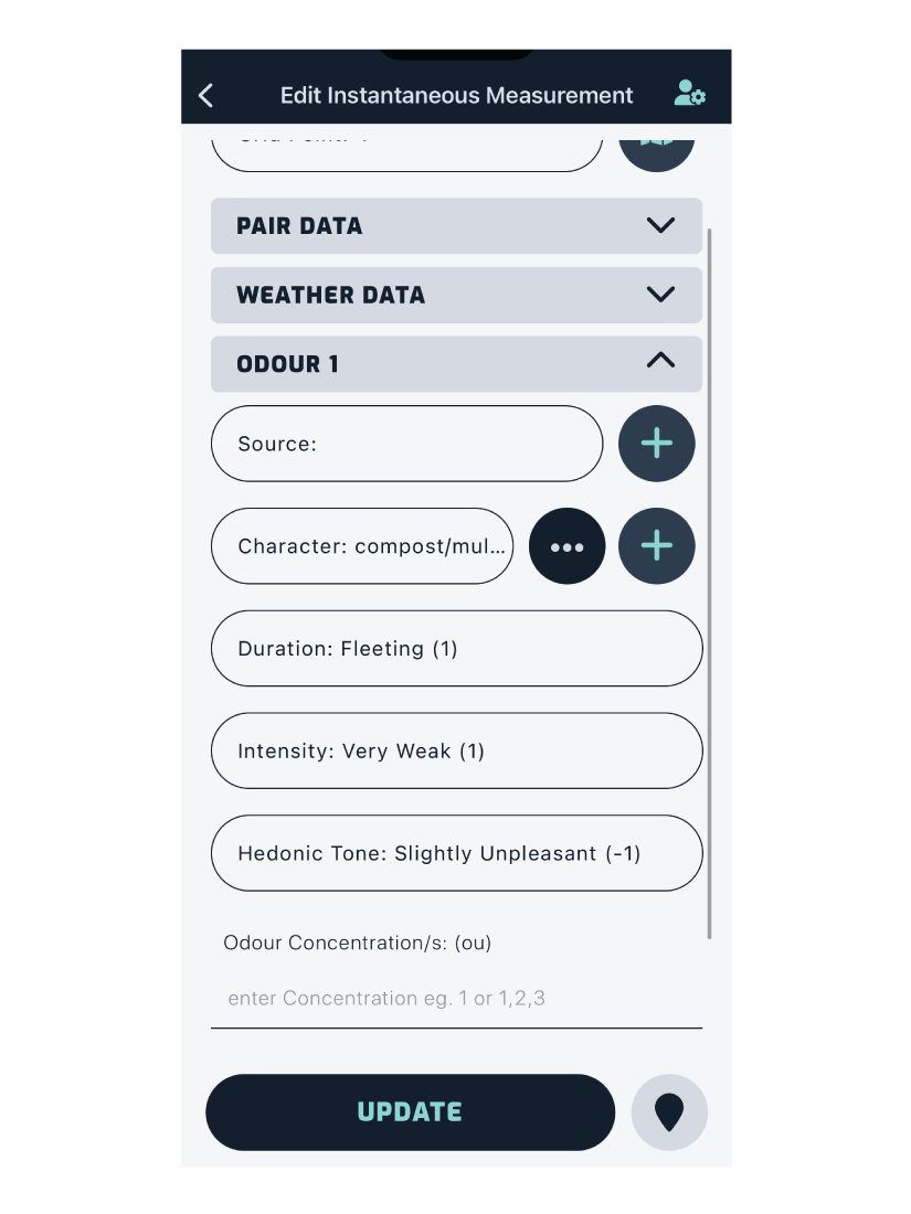
Below are examples of each section within editing an instantaneous measurement.
Timed
Editing timed measurements is similar to instantaneous, with the exception of sniff data and the odour managers.
Odour Managers
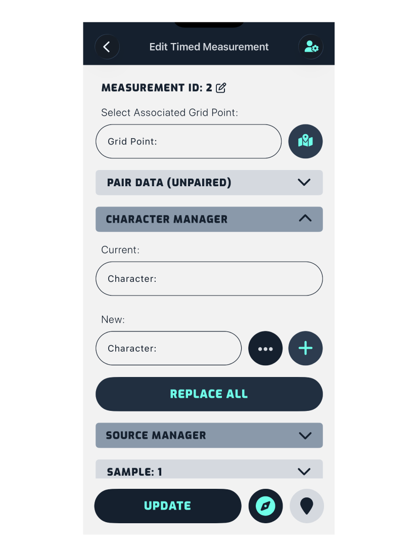
Character Manager
The character manager can update multiple sets of sniff data simultaneously.
For example, if a character was misspelled, instead of correcting each occurrence individually across the 60 sniffs, you can select the misspelled character in the first dropdown, select the correct one in the second dropdown, then tap Replace All.
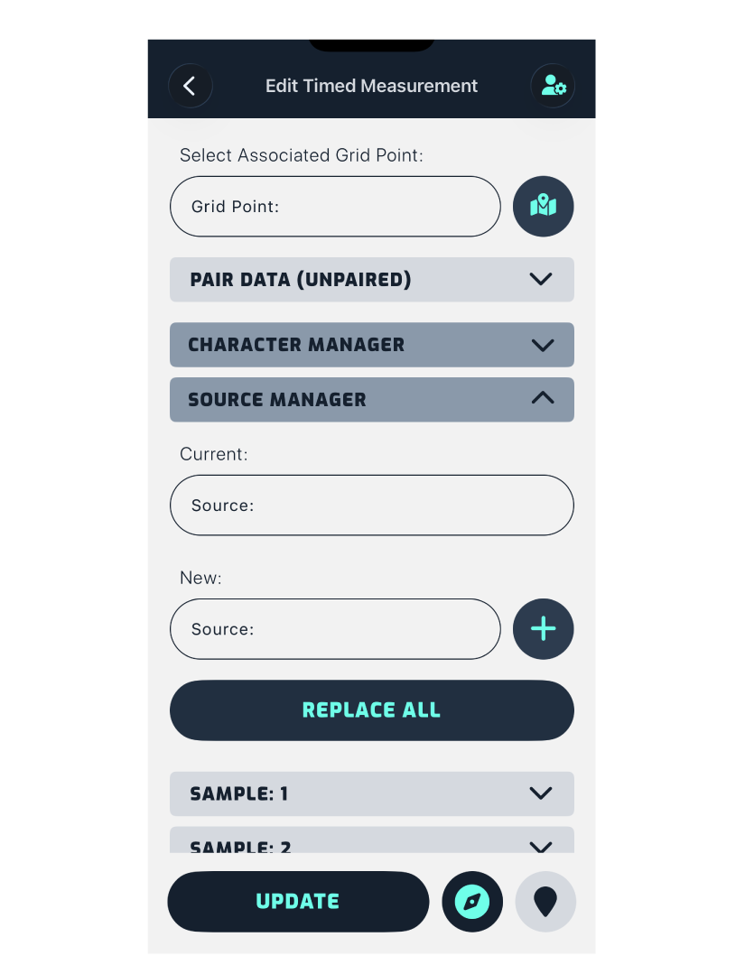
Source Manager
Works the same way as the character manager.
Sample (Sniff) Data
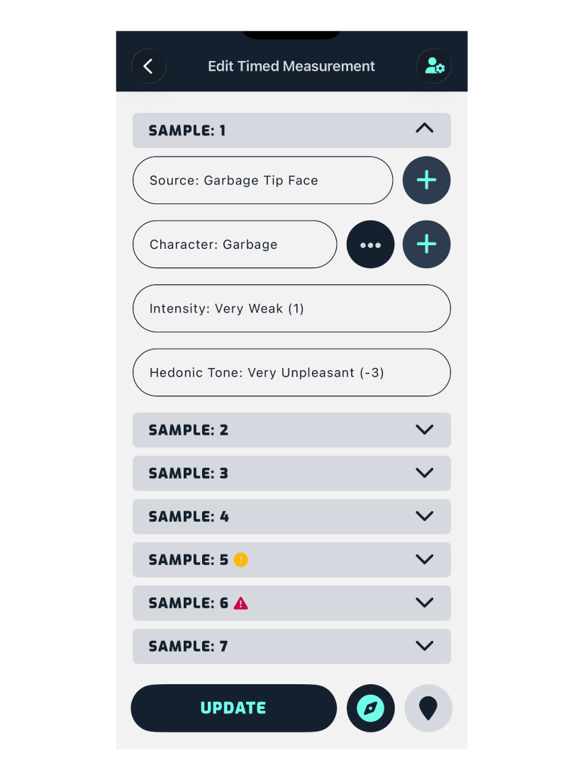
For timed measurements, each individual sniff can be edited to correct mistakes, or to enter data if the timer finished before you were able to make the recording.
- A yellow icon on a sample means data is present, but no tone has been recorded.
- A red icon means there’s a mismatch: either a character or source is missing an intensity, or an intensity/tone exists without a matching character or source.
Measurement Location
If the location of a measurement is incorrect, you can update the coordinates by tapping the button at the bottom right, then dragging the map until the marker is positioned in the correct location.
Pollutant Data
Edit or add pollutant data as required.
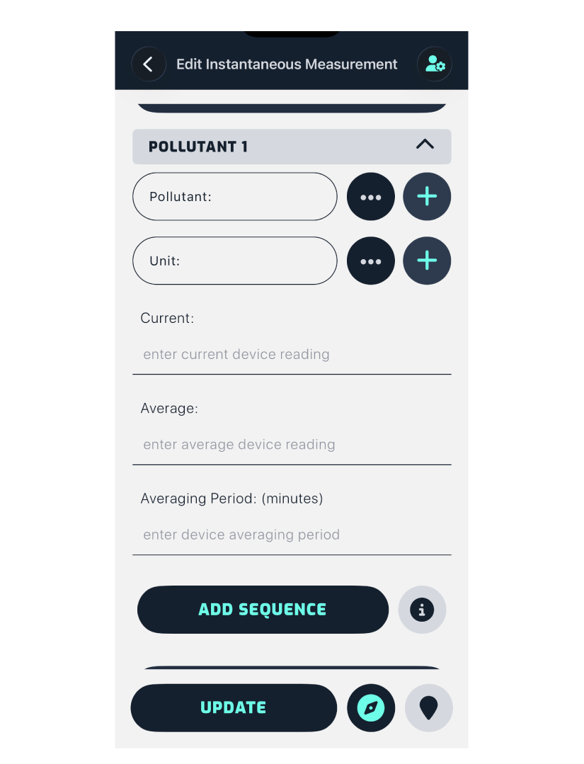
Tapping Update applies the changes and takes you back to the measurement details screen.